GET logo
  • News
  • The Company
    • History of the Company
    • Activities of the Company
    • Clients of the Company
    • Membership in Professional Associations
    • ISO Certificates
    • Careers
    • Downloads Available
  • Services
    • Geology
    • Mining Projects
    • Surveying and Geodesy
    • The Environment
    • Data Processing
    • Geographic Information Systems
    • Land Use Planning
  • Solutions
    • For the Mining Industry
    • For the Construction Industry
    • For Design and Architectural Offices
    • For Municipalities, Cities, Regions
    • For the Authorities of the Czech and Slovak State Administrations
    • For Agriculture and the Food Industry
    • For Churches and Religious Communities
  • Projects
    • Projects in the Czech Republic
    • Projects Abroad
  • Contacts
    • Headquarters
    • Branch Office Brno
    • Branch Office České Budějovice
    • Branch Office Liberec
    • Branch Office Teplice
    • Branch Office Úpohlavy
    • Slovak Republic
  • Čeština

  • Čeština
  • English


Services

  • Geology
  • Mining Projects
  • Surveying and Geodesy
  • The Environment
  • Data Processing
  • Geographic Information Systems
  • Land Use Planning

Solutions

  • For the Mining Industry
  • For the Construction Industry
  • For Design and Architectural Offices
  • For Municipalities, Cities, Regions
  • For the Authorities of the Czech and Slovak State Administrations
  • For Agriculture and the Food Industry
  • For Churches and Religious Communities

Fulltext

  • LETECKÉ SNÍMKOVÁNÍ

  • GEOLOGICAL DOCUMENTATION

    Geological documentation of mining

  • PEDOLOGY

  • AGRICULTURAL LAND RESOURCES

    The withdrawal of land from the agricultural land resources

  • Predictor – LimA

    Noise measurement and acoustic studies

  • GEOMINE

    GIS application for mining industry

Projects in the Czech Republic

Since its inception in mid-1993 the G E T s.r.o. Company has implemented approximately 5,000 commercial contracts of varying scope in the Czech Republic. Included among the reference projects are only selected major contracts by means of which we demonstrate the comprehensiveness of our work capability.


Cínovec-Východ

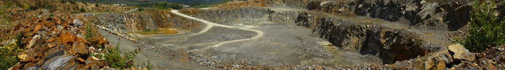
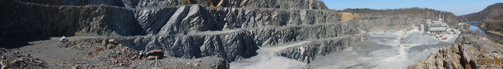
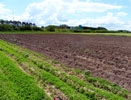
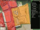
Cínovec-Východ: the Definition of Sn, W and Li Ore Reserves in the Foreland of the Cínovec-Jih Deposit

The aim was to define a new deposit of Sn, W and Li ores in the north-eastern extension of the existing deposit Cínovec-Jih B3123700, both usable for underground mining. In the same area exists the lithium ore deposit Cínovec-Odkaliště B3268300, represented by tailings from the processing plant of the former Rudné Doly State Enterprise. The evaluation of the deposit was based on archival data, without new technical and laboratory works.

more

Krásno-Koník

Krásno-Koník: The definition of a new tin and lithium ore deposit in Western Bohemia

The aim was to evaluate of archival data and define a new deposit of Sn and Li ores in mining district of Horní Slavkov-Krásno in the Slavkovský Lest Mts. (Western Bohemia). The mineralization is developed in the endocontact of the granites of the young intrusive complex of the Karlovy Vary Massif with crystalline rocks of the Horní Slavkov unit built by migmatites, paragneises and orthogneises.

more

Bratčice

Bratčice: from geological exploration to the extraction of a sand and gravel deposit

In 2003, we prepared the documentation for the establishment of the Medlov I Protected Deposit Area and in 2003-2006 the documentation for the declaration of the Medlov Working District and for reducing the already existing Bratčice Working District: a new calculation of reserves, a comprehensive remediation and reclamation plan, an environmental impact assessment (EIA) of a proposal to extend the working district and the processing of a general mining map. In 2006 geological research was implemented at the deposit aimed at clarifying the thickness and the shape of the massive obscured erosion furrow, filled with rubble, the results from which facilitated the identification of the optimal location for penetrating into the space behind the furrow. From 2003 to the present we have been conducting the geological documentation of the mining activities undertaken at the deposit.


Bratčice

Bratčice: a pedological survey for the exemption from the Agricultural Land Fund

A comprehensive assessment of soil conditions for removal of land from the agricultural land was one of the initial documents for authorization procedure for opening new projected mining activity in the Medlov locality. Field works were focused on the documentation of the soil profile and the thickness of humus horizon and the subsoil. On an area of over 90 hectares were made 50 pedological probes to a depth of 60-90 cm. Thickness of the humus horizon was further precised by archival documentation exploration boreholes.

more

Haldy

The detection of shut-down and abandoned mining waste storage sites

Between 2010 and 2012, the G E T s.r.o. Company, as a member of the OPV - GET - GV Consortium participated in the project "The detection of closed and abandoned storage sites for mining waste posing a serious risk to the environment or to human health", co-financed by the European Union Cohesion Fund and the State Budget of the Czech Republic within the framework of the Operational Programme Environment. This project was coordinated by the Czech Geological Survey - Geofond. The data processing in the GIS and the development of an application for the purposes of the project were carried out under the auspices of the Arcdata Praha s.r.o. Company


Hrušovany

Hrušovany u Brna – Protlas: the legislative ensuring and expansion of gravel mining

Defined in the year 2002 at the mined gravel deposit in Hrušovany u Brna, were resources of a reserved mineral feldspar and a reserved deposit of this mineral named Hrušovany u Brna – Protlas was established. In 2003, we prepared documentation for the legislative protection and exploitation of this deposit. In 2004-2005 documentation was prepared for further expansion of its exploitation, in particular a general remediation and reclamation plan and an environmental impact assessment.


Ledce

Ledce u Židlochovic: the legislative ensuring and expansion of gravel mining

In 2001 at the deposit of feldspar and gravel Ledce – Hrušovany u Brna, we prepared the documentation for the determination of the Ledce u Židlochovic Working District and the materials required for a mining permit. Mining operations began in 2002. In 2004-2005 documentation was prepared for the expansion of this working district: a new calculation of reserves, an alternative comprehensive remediation and reclamation plan and an environmental impact assessment (EIA) of a proposal to expand this working district.


Břežany

Břežany II: geological survey, calculation of the reserves of refractory clays

The geological survey verified a new source of high-quality refractory clays suitable for firing in a rotary kiln. The whole as-yet unmined deposit was reassessed in accordance with these new conditions of utilisation. 10 new exploration boreholes were excavated to depths of up to 35 m. This new calculation of reserves was prepared as a basis for the State Record of Reserved Deposits of Reserved Minerals, for the registration and protection of the reserves and for implementing the preparation, opening and exploitation of the deposit.


Myslinka

Myslinka: prospecting a new deposit for ceramic clays and kaolin

The aim of the geological works was to verify the prognosis source of non-refractory ceramic clays and kaolin for the ceramic industry. In the Quaternary cover brick materials were evaluated as a non-reserved mineral in the overburden of the reserved deposit. The verification of the area and of the depth limit of the development of the deposit was carried out by implementing eight new deposit core boreholes. A recalculation of the reserves was undertaken to provide a basis for recording the reserves in the State Records of Reserved Deposits of Reserved Minerals and for the deposit protection.


Send inquiry

Not binding inquiry


  • Geology
  • Mining Projects
  • Surveying and Geodesy
  • The Environment
  • Data Processing
  • Geographic Information Systems
  • Geometric plans
  • Land Use Planning
  • Projects in the Czech Republic
  • Projects Abroad
  • Services
  • News
  • Contacts

Copyright © 2014 GET s.r.o.
designed by SpinMedia.cz